In this Daily: The Hiking Trails in Las Catalinas
In addition to the 42km of single track mountain biking trails in Las Catalinas, which cover much of the surrounding tropical dry forest and function as multi-use trails for both hiking and biking, there are also five trails in town that are dedicated exclusively to hiking.
These five trails -- Union, Cresta, Danta, Dantita, and McHenry -- range from the waterfront up to some of the highest points in Las Catalinas, and feature numerous lookout points as well as the chance to encounter birds and other wildlife.
The Trails At Las Catalinas
Union
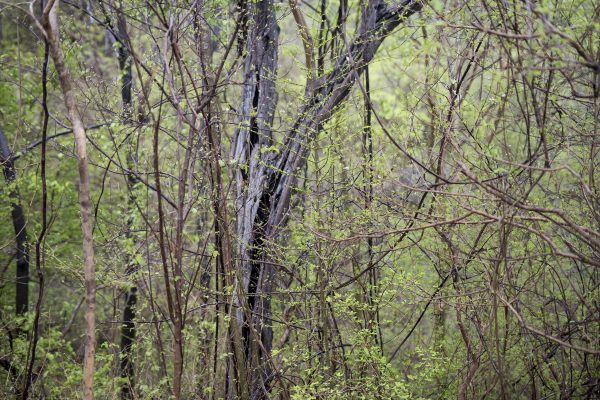 A glimpse through the trees on Union during early green season, when animals are active, but also easy to spot thanks to thin foliage
Length: 100m
Trail Profile: A short hike through the forest on the back of Las Cruces
The shortest trail in Las Catalinas, Union is a hundred-meter stretch that links several trails at the top of the mountain. Beginning at the midway point of Secreto, Union climbs directly up the hill to meet with Las Cruces, McHenry, and La Cuesta, and provides a short exit after the initial stretch before the long descent into the Zapotal valley.
Traveling quietly along this trail offers the chance to encounter birds and animals, as the forests on either side of the trail are full of life.
La Cresta
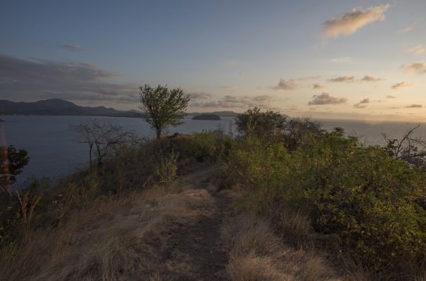 The View from the Top of La Cresta
Length: 0.4km
Trail Profile: A hike to a hilltop vista with panoramic views and a platform to relax
La Cresta begins just up the hill north of Beach Town, on the overlook between Playa Danta and Dantita. From there, this trail climbs through the forest, alternating between open views of the ocean and walking through deeper forest filled with life, before arriving at the overlook at the start of Secreto.
From this vista between Punta Guachipelines and Las Cruces, there are panoramic views South towards town and Potrero Bay, west to the Catalinas Islands, and north to Playa Carmel.
These views and the platform sitting at the top make this hilltop vista well suited to meditation, a break to enjoy the breeze, or a hilltop lunch after a hike.
Dantita
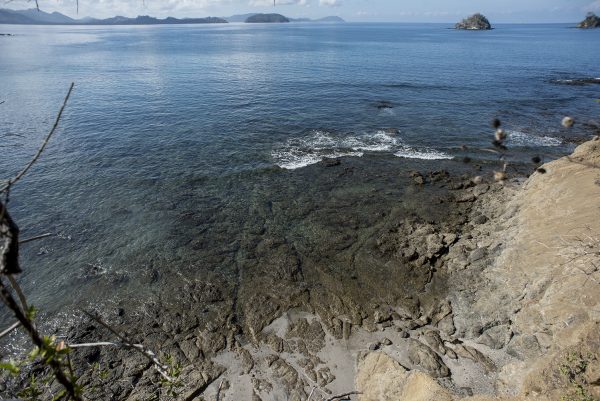 The View from Dantita Trail
Length: 0.9km
Trail Profile: A short trek along the coastal hillside that links Playa Danta and Dantita
Dantita is a hiking trail that links Playa Danta and Playa Dantita, which crosses the hill between the two beaches and offers alternating views of tropical dry forest and the water with a constant presence of the ocean breeze. The vista midway through the trail has a view straight through the trees towards the Islotes Pitahayas, which are often surrounded by frigatebirds in flight.
A short trek through the coastal forest before a morning or afternoon at Playa Dantita
Danta
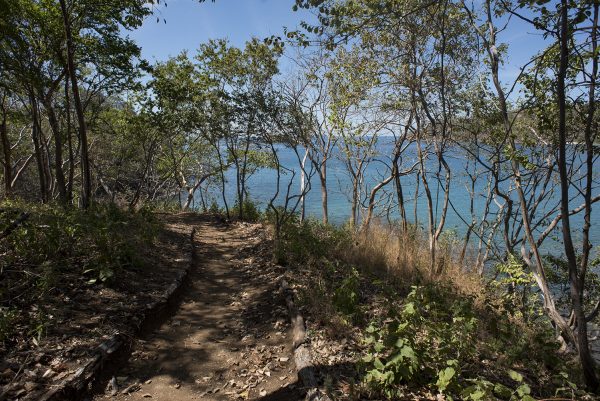 The View from Danta Trail
Length: 0.6km (depending on start point)
Trail Profile: Stroll along the beach, starting in town before heading out onto Punta Penca
The Danta trail starts by Plaza Danta, and traces the beach all of the way down past town to the small mirador at the end of Punta Penca. This trail has a diverse set of surroundings, starting off just a few feet away from the walkable street of Paseo del Mar, passing the Beach Club and the Monkey Corridor, curving past Calle Cartagena, and then rising up through the forest at the base of Paseo Punta Penca before arriving at the point, all in constant view of the water.
The small park at the end of Punta Penca has wooden benches and seating, as well as views in three directions -- south towards Potrero Bay, west out towards the ocean, and north towards Punta Guachipelines, the islotes Pitahayas, and the bay.
McHenry
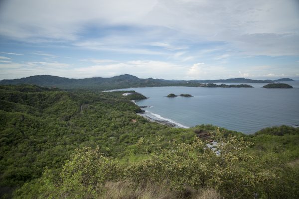 The View from the Top of McHenry Peak
Length: 3.1km
Trail Profile: A hike to the top of McHenry Peak and along the ridgeline surrounding town
The McHenry trail begins just across Camino Las Catalinas from Plaza Central, where it climbs to the top of McHenry Peak and then loops across the mountaintops towards Windy Peak, crosses the Donkey Trail, and then converges back with Union, Las Cruces, and La Cuesta.
McHenry first hugs the front of McHenry Peak, with a constant view of town and the ocean as it winds up along the hillside. After converging with Zapotal, McHenry peak begins to break the treeline, before reaching the McHenry Peak vista at the top, which has a full panoramic view over town, the coast, and the surrounding region of Guanacaste. The next phase of the trail is along the tops of the hills, with prominent views and four more lookout points on Windy Peak.
The hike to McHenry Peak and back is a bit more than 2km round trip, with the full trail offering a longer hiking loop that traces the entire ridge surrounding Las Catalinas.
Walk the Trails
All trail heads in Las Catalinas are within a short walk of town’s homes and hotels, which makes it easy to depart straight from home onto these coastal and dry forest trails, with no need for transit time or packing and unpacking gear.
[maxbutton id="1" url="https://cta-redirect.hubspot.com/cta/redirect/4917861/0690bda6-1dea-45ba-8b6e-c42257bfec1f" text="Hike them next time you're in town" ]